After a year of war between Israel and Hamas, the conflict in the Middle East continues to dominate the world’s attention. But it’s impossible to understand the headlines without knowing the history.
The “Holy Land”—a moniker that Israelis and Palestinians share for their beloved region—has been mired in conflict for more than a century. When the long-decaying Ottoman Empire collapsed after World War I, both Jews and Palestinian Arabs expected a state where they could finally be in charge of their own fate. But why was a piece of land the size of Massachusetts promised to two peoples? Explore the history behind the Israeli-Palestinian conflict, its key moments and figures, and the prospects and obstacles for peace.
ISRAELI-PALESTINIAN CONFLICT
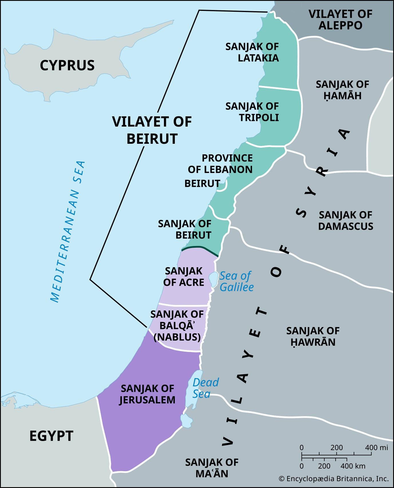
Ottoman Palestine after 1888
The area that today comprises Israel and the Palestinian territories was crafted when the Ottoman Empire fell after World War I. The area occupied by the British included the Ottoman sanjak (district) of Jerusalem and the sanjaks of Acre and Balqāʾ in the Beirut vilayet (governorate), while the sanjaks north of Acre were occupied by the French. Since the areas occupied by the British roughly coincided with the historic region of Palestine, the British adopted the name for its mandate—that is, its governorship of the region as authorized by the League of Nations.
Part of Beirut vilayet, incorporated into the Palestine mandate
Not part of Beirut vilayet, incorporated into the Palestine mandate
Part of Beirut vilayet, not incorporated into the Palestine mandate
ISRAELI-PALESTINIAN CONFLICT

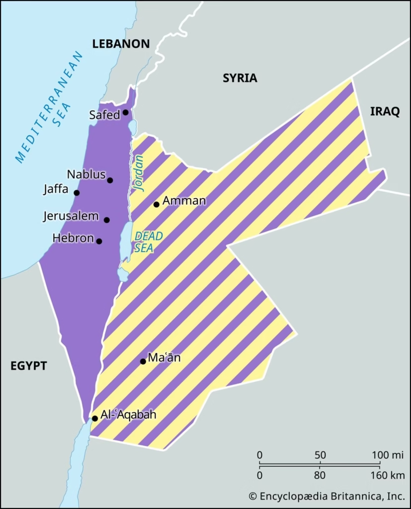
British mandate (after 1923)
The British mandate also included the area east of the Jordan River, called Transjordan (later renamed Jordan). In 1923 Great Britain allowed the Hashemite dynasty to administer that portion and granted it full independence in 1946. The land west of the Jordan River remained under direct mandatory administration until 1948, when the British withdrew and the state of Israel was created.
British administration until 1948

Transjordan
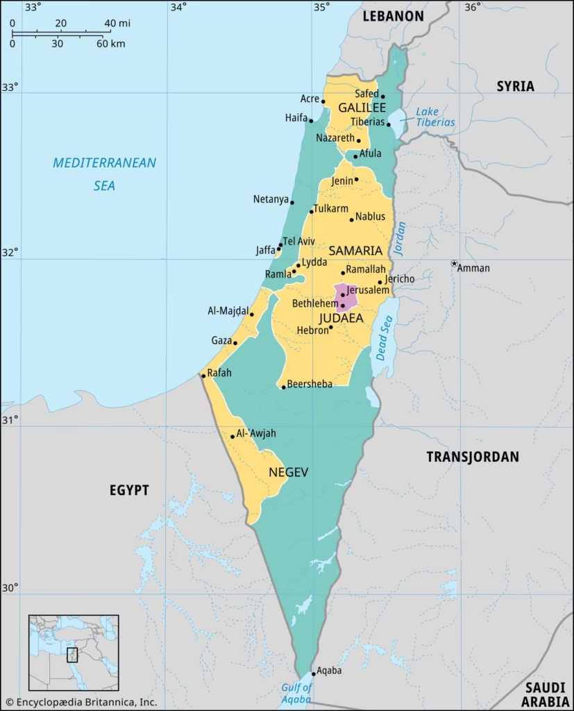
1947 partition plan
According to United Nations Resolution 181, Israel was supposed to look like the area shaded in green, while an Arab state was supposed to be created in the area shaded in yellow. The area around Jerusalem would have been administered by an international regime. But the Arabs rejected partition, and the borders were ultimately determined by the 1948 Arab-Israeli War. An Arab state west of the Jordan River was never created.
Proposed Jewish state
Proposed Arab state
Proposed Jerusalem district
ISRAELI-PALESTINIAN CONFLICT

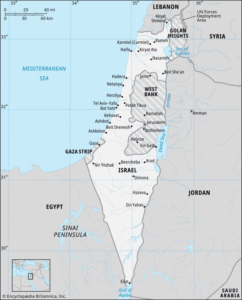
1949–67
The internationally recognized borders of Israel, the West Bank, and the Gaza Strip were established by the armistice agreements between Israel and its neighbors at the end of the 1948 Arab-Israeli War. The West Bank and the Gaza Strip were occupied by Jordan and Egypt, respectively, and in 1950 Jordan annexed the West Bank

ISRAELI-PALESTINIAN CONFLICT
1967–95
In the Six-Day War of 1967, Israel occupied the West Bank, the Gaza Strip, the Golan Heights, and the Sinai Peninsula. In 1982 the Sinai Peninsula was returned to Egypt in accordance with the Camp David Accords (1979).
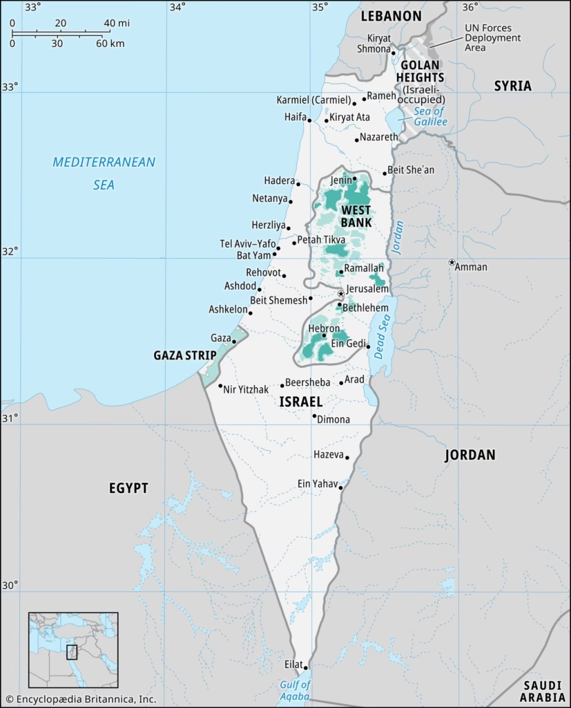
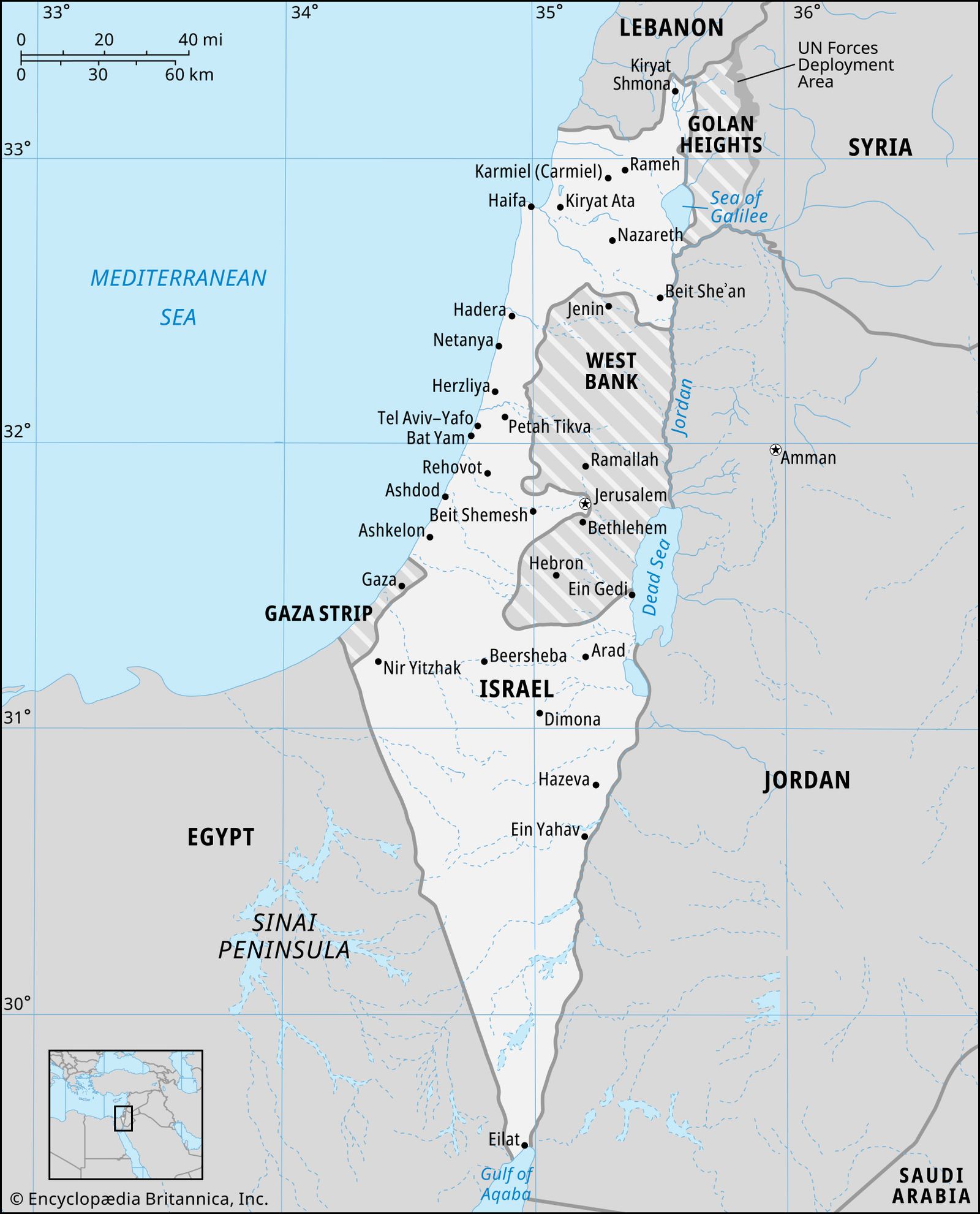
995–present
In 1995 the Oslo II Accords divided the West Bank and the Gaza Strip into areas under Palestinian administration and security (“Area A”), areas under Palestinian administration but joint Israeli-Palestinian security (“Area B”), and areas under Israeli administration and security (“Area C”). In 2005 Israel withdrew from the Gaza Strip entirely, although it reentered Gaza in 2023 during the Israel-Hamas War.
Full Palestinian civil and security control (“Area A”)
Full Palestinian civil control; joint Israeli-Palestinian security control (“Area B”)
Full Israeli civil and security control (“Area C”)
Map depicts the borders in 1995.